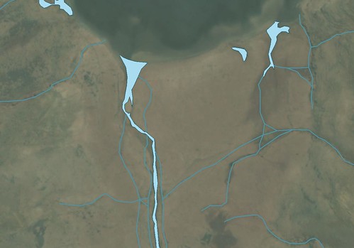
Rapa Island, North Shore - Ikonos Image with Digitized Hydrography Layer (1:1,250)
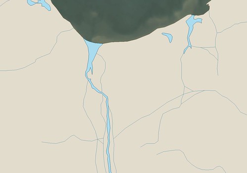
Rapa Island, North Shore - Other Precision (Ikonos) Map with Digitized Hydrography Layer (1:1,250)
Sure, I've been busy with family, friends and 12 dozen tamales served all day Christmas day at my home. Come Christmas evening I was still entertaining guests and wishing I could continue working on my current mapping project, Rapa Island. I have mapped this island a number of times, each time not completely satisfied with the finished project. So I've decided to work on this island one more time. First I redigitized the shoreline working at scales between 1:1,250 to 1:850 using a hi-res Ikonos image. After completing the shoreline, I decided to work on the island's hydrographic layer. Initially I've classified each valley as a potential stream course. The island has a number of permanent streams fed by frequent rain storms and springs. Most of the streams I've currently mapped will be reclassified as intermittent.
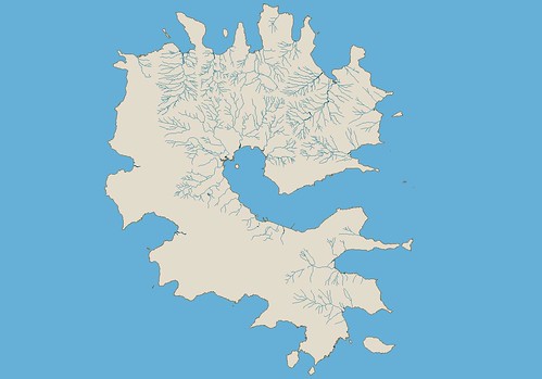
Rapa Island - Other Precision (Ikonos) Map with Hydrography Layer (1:52,500)
I've mapped most of the hydrographic layer over the last 5-days, actually over the last 5-evenings. The hydrography of the western portion of the island remains to be digitized. I hope to have the layer completed within the next few days. When it is finished, I intend to digitize the vegetation layer next. I'll keep you informed as to my progress.
Enjoy! Merry Christmas and Happy New Year!
No comments:
Post a Comment