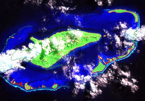
Raivava'e Atoll - EVS Precision Map on Landsat S-06-20_2000 (1-55,000)
As most of my regular readers know, the bulk of my mapping work is derived from Landsat ETM+. My primary reason for using Landsat ETM+ as base imagery is consistency of product. Typically, anywhere on earth this imagery is freely available, virtually cloud-free and consistently resolved to 14.5-meters per pixel. Great for my worldwide island mapping work. Plus, there are minimal copyright issues when using this imagery. All that is asked is that you credit the source imagery. Did I say "virtually cloud-free"? That is everywhere but in humid climates, in other words in and around islands. Oh, well, it is merely a challenge that the accomplished mapper learns to work around.
The above image is an example of cloud-obscured island imagery. Most of Raivava'e Atoll is visible, but those areas not visible are significant. How does one resolve these areas using copyright-free data (credit source data)? If I am unable to secure Landsat 1990 imagery, which quite often enables one to resolve cloud-obscured areas, I go to Shuttle photography. Specifically, searching for ISS (International Space Station) imagery.
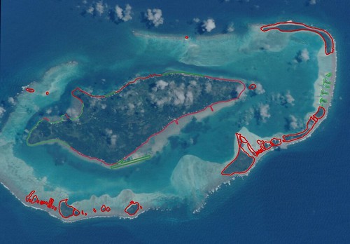
Raivava'e Atoll - EVS Precision Map on ISD_ISS001-375-13 Modified (1-55,000)
Raivava'e Atoll has two images that show the atoll with virtually no clouds. These images are sufficiently large enough that one is able to zoom into and digitize features. First, however, the ISS image must be georectified. Global Mapper allows me to georectify ISS imagery using my Landsat base imagery. In georectifying this ISS image, I used 7 GCP's to ensure the ISS image lay precisely on top of the Landsat base image.
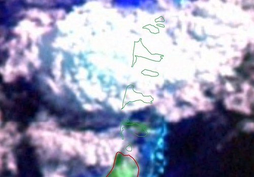
Raivava'e Atoll Outlying Motus - EVS Precision Map on Landsat S-06-20_2000 (1-10,000)
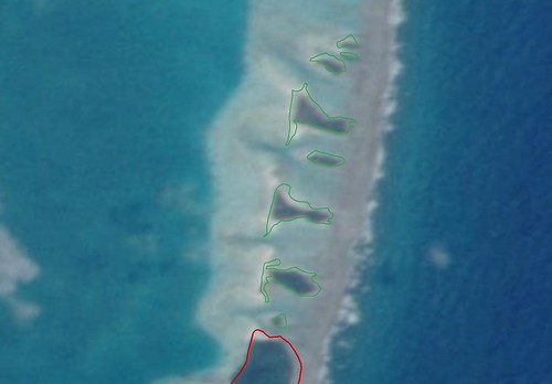
Raivava'e Atoll Outlying Motus - EVS Precision Map on ISD_ISS001-375-13 Modified (1-10,000)
Beginning with the cloud-obscured Landsat image above, I digitized as much of the atoll as possible. The cloud-obscured portions were identified and designated for further work. Visiting Shuttle photography, I found 2 cloud-free images of Raivava'e Atoll. I selected ISD_ISS001-375-13 as the better of the two images. I rotated it and cropped to the atoll. Using this modified ISS image, I was able to complete digitizing the cloud-obscured shoreline. When all else fails, I use WVS shorelines. They are crude compared to EVS precision, but they work.
I use red shorelines to designate EVS precision derived from Landsat base imagery. The green shorelines are designated as Other precision. The source for all Other precision shorelines in my Raivava'e Atoll map is the ISS imagery.
My EVS precision island map of Raivava'e Atoll is complete and I was able to digitize all shorelines in spite of clouds. Pretty cool, huh?
Enjoy!
No comments:
Post a Comment