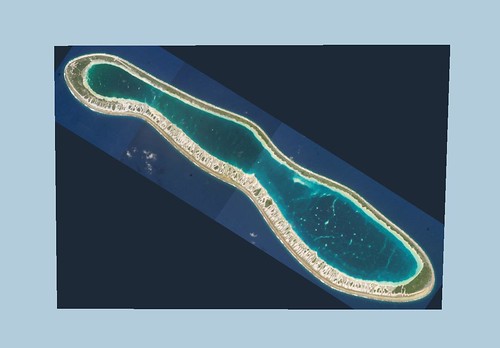
Reao Atoll - ISS004-E-12987, 12988, 12989 Images (1:100,000)
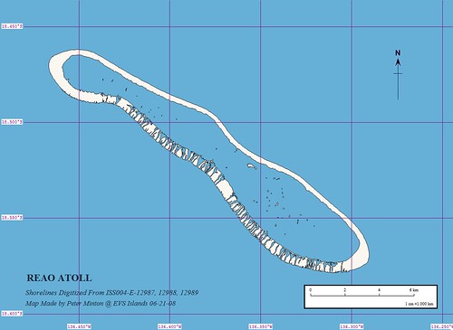
Reao Atoll - Other Precision Map - Source ISS004 Images (1:100,000)
This is my finished shoreline map of Reao Atoll FP. The imagery covering this atoll is of sufficient detail that other layers of information can be digitized, if I wish. For now I just want to complete shorelines within the Tuamotus at EVS precision or better.
Enjoy!
No comments:
Post a Comment