Mejit Island
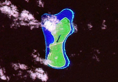
Mejit Island - Landsat Image N-59-10_2000 (1:31,250)
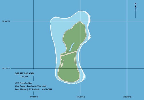
Mejit Island - EVS Precision Map (1:31,250)
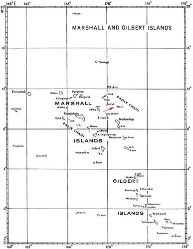
The Marshall's are home to numerous atolls, many with a classic shape consisting of a deep central lagoon surrounded by shallow reefs and an occasional sliver of land with vegetation. That is except for islands like Mejit. It is a chunk of land between 5 to 10 meters high covered with lush vegetation and completely surrounded by a shallow reef. The shallow fringing reef makes landing difficult. There are 497 people living on Mejit. The islanders have an excellent school, medical facility and fishing is great. They also have a freshwater lake on their island that is supposed to be wonderful to swim in. Also, it seems that many of the coral atolls harbor poisonious fish, but the fish of Mejit are safe to eat.
How would you like to live and die on this small island? It is approximately 1 sq mile in area. To live your entire life within 1 sq mile seems confining. I am confident Mejit has had residents that have lived on this piece of coral from birth to death. Were they frustrated by their island's size limitation? Or were they so caught up in their daily lives that the size of their island never really entered their minds? Who knows!
If it appears the map was simple and fast to construct, you are right. It is a simple map, but the vectors are EVS precise and that makes for a good map.
Enjoy!
No comments:
Post a Comment