ARB-127 Ornithology of the Marshall and Gilbert Islands
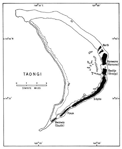
Taongi Atoll (H.O. 6024) ARB-127
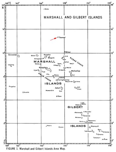
Marshall and Gilbert Islands ARB-127
I enjoy reading the Smithsonian Atoll Research Bulletin available at the above link as PDF documents. First encountering them at Scripps Institute of Oceanography's library, I most especially enjoyed the detailed discussion of specific atolls. The articles are scholarly in content, yet accessible to the interested public.
A few years ago I took a class on how to work with enamel. It was instant gratification. Coat the copper plate with different colors of enamel, cook for about 1-minute at 1500°, let cool for 5-minutes and you have your finished work of art. You'll never guess what I made, my very first project was a map of an atoll, Taongi Atoll. I used the ARB-127 map based on chart H.O. 6024. It turned out nice. Why Taongi, why not!
Last week I was browsing my collection of ARB's and was looking at the collection of maps of all of the Marshall and Gilbert Islands which make up a significant portion of ARB-127. I studied the Taongi Atoll map and decided that I would make an EVS precision map of the island. Using Landsat N-59-10_2000 as my base image I constructed my map in about 4-hours. The bulk of the time was spent digitizing the coral heads scattered throughout the lagoon. But more on that later.
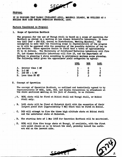
Operation Hardtack - Proposal to include Taongi Atoll as H-bomb test site
While researching the atoll, I came across a once classified document proposing that Taongi Atoll be used as a site to explode atomic bombs. This atoll would have been the third atoll besides Bikini and Enewetak, to be catastrophically damaged by slowly desolving nuclear radiation. Cooler heads prevailed and Taongi Atoll was spared. The ordinances intended for Taongi Atoll were exploded at the Nevada test site.
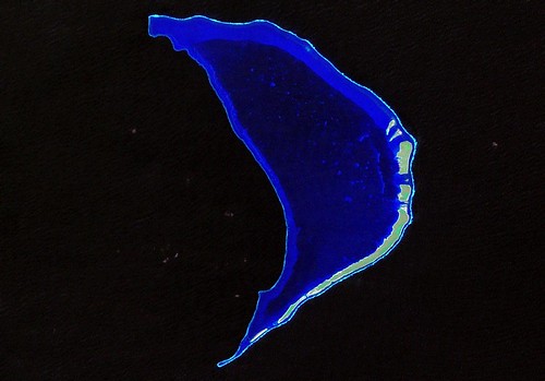
Taongi Atoll - Landsat Image from N-59-10_2000 Standard Landsat ETM+ Colors (1:110,000)
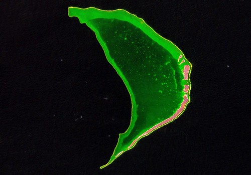
Taongi Atoll - Landsat Image from N-59-10_2000 Modified Colors for Reef Digitizing (1:110,000)
Now for my map. I was convinced I could create a map that would be far superior to the H.O. 6034 version in ARB-127. Looking at the standard Landsat image, I could see that the mapping would be uncomplicated. Curious soul that I am, I decided to play around with colors. After a number of color tweaks, I discovered the puke green image. The shallow reef was a lighter puke green and the deep reef a different shade of green. As a bonus this color tweak turned the island vegetation into a reddish pink. In addition, this color scheme allowed for a greater number of coral head to be digitized.
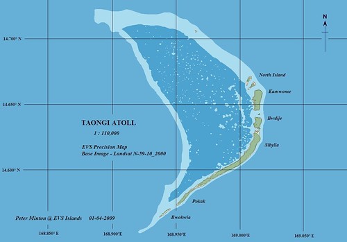
Taongi Atoll - EVS Precision Map (1:110,000)
And here is my finished map. The scale is 1:110,000 (1 cm = 1.1 km). My finished EVS precision map of Taongi Atoll contain my normal vector layers; island polygon, vegetation, shallow reef and deep reef. I tried something different when labeling. I used a feature in Global Mapper to assign text to a specific point and in this way I assigned lat/lons. The island names and other text were also assigned using Global Mapper. I used MS Draw to construct the lat/lon lines. I think this is a good mapping effort.
Today, the atoll is a nature preserve and remains uninhabited. Thanks to some unknown beaurecrat, the island remains nuclear radiation free!
Enjoy!
No comments:
Post a Comment