View Larger Map
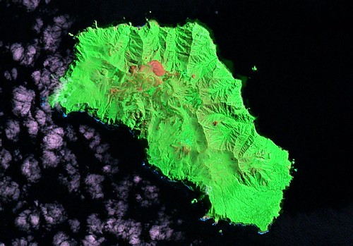
Gough Island - Landsat S-29-40_2000 (1:65,000)

Gough Island - EVS Precision Map with 50 Meter Contours (1:65,000)
Gough Island, a dependency of Saint Helena Island, is located in the distant south Atlantic. Today, South Africa maintains a weather station on the southeastern tip of the island. This is a blustery portion of the Atlantic and the island is subject to weather extremes. For more detailed information follow this link.
I actually digitized the island shoreline last summer. I wanted to fancy the map up, but had other chores to do. Now that I fancy my maps with Marplot, I finished this map tonite, April 15th - Tax Day. Taxes are a drag, but my map is nice.
Enjoy!
No comments:
Post a Comment