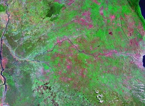
Lukuga River - Entire River Overview Landsat S-35-05_2000 (1:1,000,000)
I am done! To manually digitize a river is a challenge. Lots and lots of twists and turns make up the river's shoreline, as well as water-inundated areas. One frequently must decide where the river shore ends and the river begins. After one completes the river shore, then comes the islands. The Lukuga River has almost 1,000 island polygons. The majority of this polygons are very small, but the conscientious map maker digitizes every visible feature that might possible belong to a certain layer. Let's take a look at what I was able to accomplish.
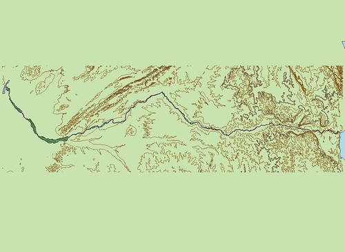
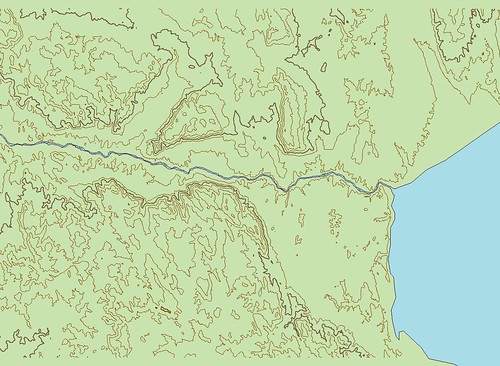
Lukuga River - Entire River Overview EVS Precision Map with 100-Meter Contours (1:1,000,000)
At this scale the effort might not look very impressive. However, having digitized this east-west flowing African river and it's many islands, it is an impressive effort. I've added SRTM generated 100-meter contours. Lake Tanganyika makes up the eastern edge and the Lualaba River is the western edge. Now for a few close-ups.
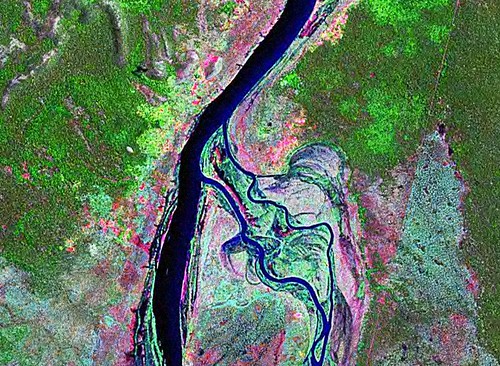
Lualaba and Lukuga Confluence - Landsat S-35-05_2000 (1:50,000)
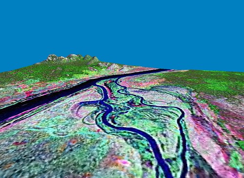
Lualaba and Lukuga Confluence - 3D View Landsat S-35-05_2000 (1:50,000)
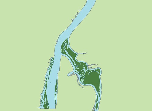
Lualaba and Lukuga Confluence - EVS Precision Map (1:50,000)
This series of images show the confluence of these two rivers. The Lukuga has meandered over relatively flat westward sloping terrain for about 200 kilometers before joining the Lualaba. The large island at the western end of the Lukuga is a water inundated feature that was a challenge to digitize. Water and land quite often blend making digitizing difficult.
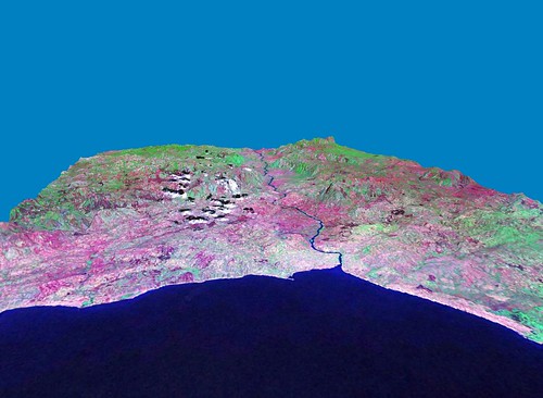
Lake Tanganyika and Lukuga Confluence - 3D View Landsat S-35-05_2000 (1:250,000)
Lake Tanganyika and Lukuga Confluence - EVS Precision Map with100-Meter Contours (1:250,000)
These images show the Lukuga flowing from Lake Tanganyika through the town of Kemba. The Landsat image shows agricultural lands throughout this area. The river then courses through a cleft between the hills to the west.
I'm going to go ahead and post this. I have one more series of images to include, but I'll add them when I return after a date with my wife. I hope you all find this effort interesting. I, myself, find it extremely satisfying. This river is mapped at EVS precision, manual digitizing from Landsat ETM+ 14.5-meter resolution base imagery.
Enjoy!
No comments:
Post a Comment