On February 21, 2008, while reading my science RSS feeds, I came across an article about some stunning radar images of methane seas located on Titan. I followed the links and came across the initial image showing strips of the surface of the northern polar region of Titan. And sure enough, there was something that looked like a sea. And best of all, the image of the sea showed what looked to be islands. "Cool, islands!", I said.
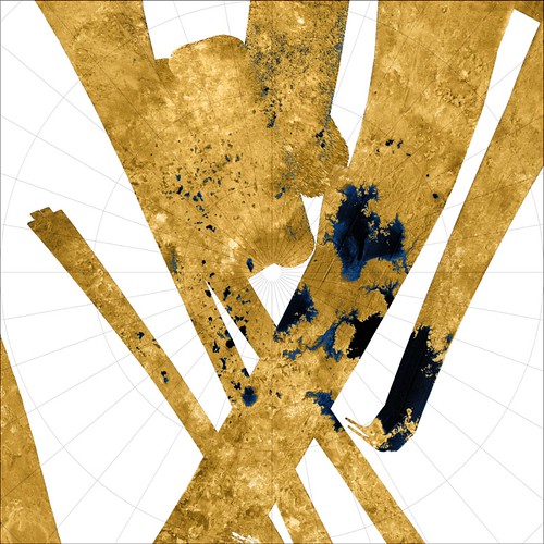
Titan Unnamed Methane Sea Base Image PIA10008
Curious mapper that I am, I downloaded the image, georectified it by deciding that 180° would be south and 0° would be north, and digitized a cluster of islands.
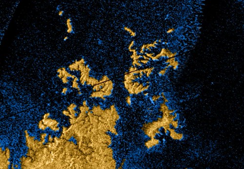
Titan Island Group - Cassini Image PIA 100008 (1:1,000,000)
Due to the interest generated by my first map, I digitized the shoreline and islands of the entire unnamed methane sea, made my map and posted it. And then the fun started.
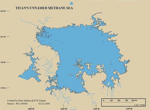
Titan's Unnamed Methane Sea
Over the past month the above map has been viewed on my site alone in excess of 1,500 times. It was picked up and posted to the following sites: Centauri Dreams, Strange Maps, Io9 Unmanned Spaceflight and a few Livejournal posts out of Russia. This map of extraterrestrial islands in a methane sea has generated lots of new traffic to EVS Islands. Hopefully, they will find the world of terrestrial islands of interest.
Enjoy!
No comments:
Post a Comment