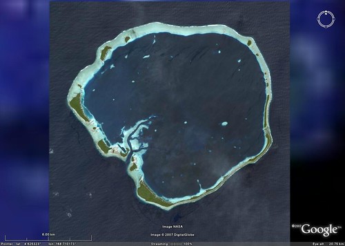
Ebon Atoll - DigitalGlobe Image in Google Earth (1:80,000)
I am busy scouting the Marshall Islands (Micronesia) for a prospect island to map, when I chance upon Ebon Atoll. It is covered by a cloud-free DigitalGlobe (DG) image. I do what I do when I scout a prospect island project - I give the island a detailed scan to see if anything out of the ordinary shows up. My scans are usually at 1:5,000 or 1:2,500, depending on the potential complexity of the island's makeup. Ebon Atoll looks to be a straight forward island mapping prospect - a typical atoll structure with most of the vegetation being coconut palms. The reef appears to be ordinary, but wait. Something is on that reef. What is it?
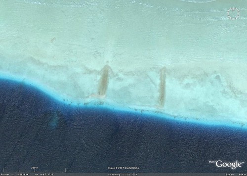
Ebon Atoll - DG Image, Detail from the Northern Reef (1:5,000)
Two unusual discolorations along the upper reef looked interesting, especially the one on the left. So I zoomed in to get a close look and then I saw it - the Reef Surfer!
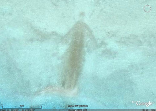
Ebon Atoll - DG Image, A Reef Surfer
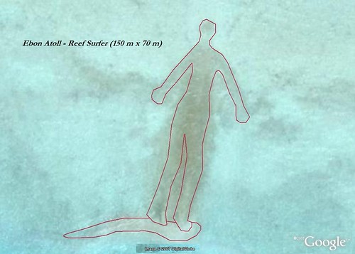
Ebon Atoll - DG Image, The Reef Surfer (150-m x 70-m)
These two images need to be published in a tabloid (with permission of DG and Google Earth). They capture the mysterious Reef Surfer in all of his glory. The Reef Surfer rivals the Nazca Lines.
Oh, sure. I can hear the skeptic saying it is only a marine vegetation stain. But I disagree. Sure it is a marine vegetation stain, but it is so much more. It is the Reef Surfer, a rival of the Silver Surfer. The Reef Surfer warns the world that global warming will sink his surfing home if we don't change our ways. At least, that what it seems he is saying. What do you think?
Enjoy!
No comments:
Post a Comment