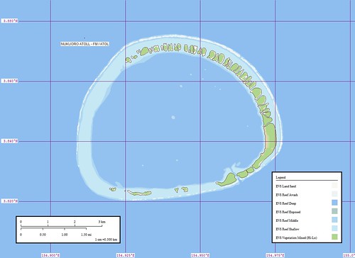
Nukuoro Atoll - Marplot Map (1:50,000)
10 - Nukuoro Atoll FM (160) - Nukuoro Atoll NASA image was posted to a popular Korean Web Portal. Lots of people came to visit because of that exposure.
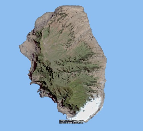
Isla Alejandra Selkirk - DigitalGlobe Image (1:75,000)
10 - Isla Alejandro Selkirk CI (160) - This is always a popular destination for the stressed person looking to escape the harsh rigors of city life. It is the place poor Alexander Selkirk was abandoned. He survived and his story was retold, with numerous rewrites by the author and a name change, as Robinson Crusoe.
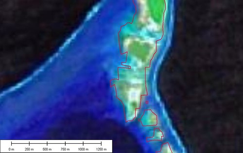
PGS Overlay
8 - Data: Improved WVS? Rival EVS? What's Going On? (190) - Over a year ago a reader suggested I look at the Prototype Global Shoreline (PGS). NIMA has made available a global shoreline derived from Landsat ETM+ imagery. When it works, it is great. When it doesn't, it leaves one wanting more. I have discussed PGS strengths and shortcomings in a number of previous posts (see Gaps and PGS to EVS) but this first one gets lots of views.
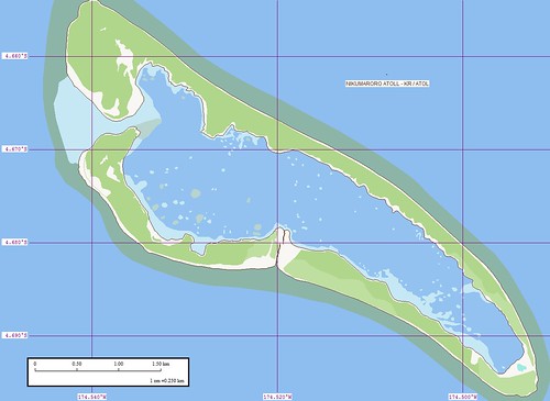
Nikumaroro Atoll - Marplot Map (1:25,000)
7 - Nikumaroro Atoll KR - Third Time is the Charm (201) - This island fascinates many folks throughout the world. It is one of the possible crash-landing sites of famed aviatrix, Amelia Earhart. I liked it before I learned of the Earhart connection. The map is one of my early best efforts. I love the reef details in the lagoon.
7 - Thoughts - "EVS" Means "Whatever" (201) - A rock group out of Australia coined the hip phrase "EVS" for "Whatever". They had their moment in the limelight and I had my moment of views checking out my "EVS". They wondered about the connection between my island maps and "Whatever". Whatever.
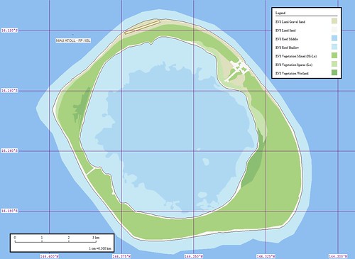
Niau Atoll - Marplot Map (1:50,000)
7 - Niau Atoll FP (201) - This is another post that got loads of views because of exposure on a portal site. The ESA image was featured on MSNBC. It peaked people's curiosity and my site became a primary destination for additional information.
4- Thoughts - To All of You Searching For "EVS, Australia" (300) - See 7 above.
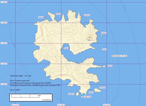
Rapa Iti Island - Marplot Map (1:60,000)
3 - Rapa Island FP (378) - Another mysterious destination for the arm-chair traveller. As a boy, I read that there were 7 women to 1 man on this island. I really wanted to visit this island! Now that I know what I know, I think I'll pass. Too many complications with one woman in my life. Could you image the "honey-do's" from 7-women?
2 - Thoughts - What's Up With Niau Atoll FP? (548) - See 7 above.
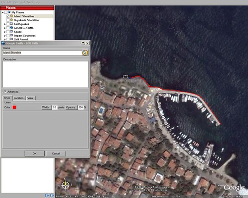
Making a Map in Google Earth
1 - How to Make a Map using Google Earth's KML Format (Revised Version) (633) - People want to make maps. Thats why many folks visit my site. I'd like to think my island projects are a strong draw. They are, but they do not generate the same interest as learning how to make your own maps. Long time readers know that I work on the "cheap". The bulk of my suite of mapping software (Marplot, ImageForge, Irfanview)is free or low cost (Global Mapper -$200, Flickr - $20 per yr, Google Earth Plus - $20 per yr). My imagery is Landsat ETM+ mosaics and DigitalGlobe imagery found on Google Earth. I have spent the last four years working at my map-making craft. I'm getting better, but it is hard work with little payback. If you are serious about learning how to make accurate, attractive and inexpensive maps drop me a line and I'll share what I've learned. ANYONE can do what I do when it comes to making maps. But you must commit consistent time and energy to develop your talent.
And that's the top 10 posts. Interesting, huh?
Enjoy!
No comments:
Post a Comment