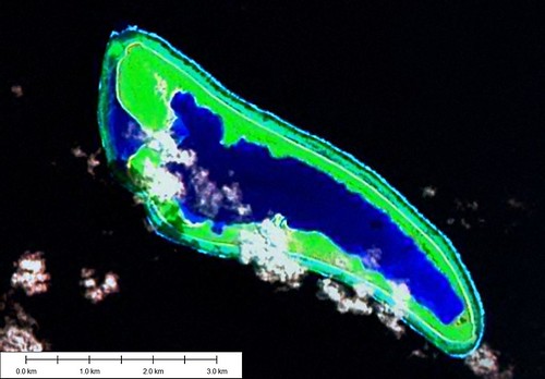
Nikumaroro Atoll - Landsat Image S-01-00_2000 (1:31,250)
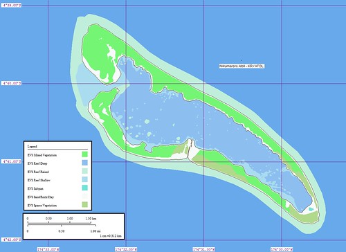
Nikumaroro Atoll - Marplot Map (1:31,250)
A year ago I thought this was a solid mapping effort. I had used both Landsat and the ESA Ikonos image (04-2001) as base images from which I constructed my map. My color choices were still not finalized, but the composition and layout were satisfactory. How things have changed in a year!
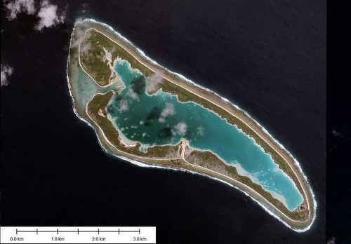
Nikumaroro Atoll - ESA Ikonos Image (04-2001)
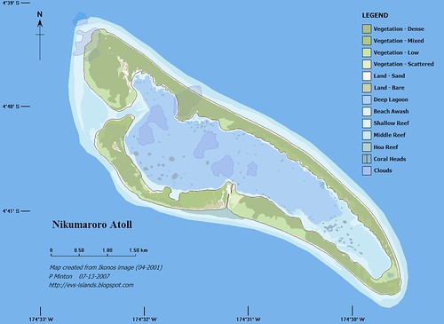
Nikumaroro Atoll - Marplot Map (1:30,000)
With this new revision, I worked exclusively off of the ESA Ikonos image (04-2001). Using Global Mapper, I georectified the image and digitized all of the layers of information from it. I selected my layers and colors within Marplot where I assembled my "nearly" complete map. I viewed it in Irfanview. Satisfied with my preliminary efforts, I moved the map into ImageForge, a freeware drawing program, to add all of my fancy stuff - Legend, Title box, modified Lat/Lon grid, North Arrow. I previewed the map once more using Irfanview. Satisfied with the mapping effort, I uploaded the image into Flickr and posted it into Blogger. As a result of this time, effort and skill all of us ended up with this exquisite map of Nikumaroro Atoll.
Enjoy!
No comments:
Post a Comment