Little Sitkin Island - View North (ISS Image Mosaic)
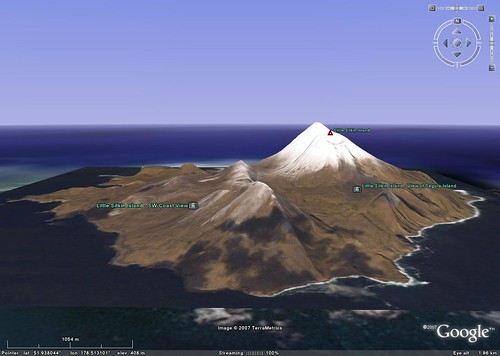
Little Sitkin Island US - A GE Tour
I'm not a Google Earth (GE) mashup person. The only way I could think to share my work posted in Google Earth was using screen shots. I am making use of Flickr slideshow feature. It will give you an idea on how a brief tour in GE might be.
The two images that makeup my overlay are from two ISS005 Images (18288 & 18289). I patched them together to create this virtually cloud-free image of Little Sitkin. Cloud-free and the Aleutians is a weather anomoly. If you do get a clear day, the islands are often shrouded in snow. These images are exquisite for clarity of ground detail. The images gets their 3D effect from the underlying data (SRTM/DEM) in GE. The western shoreline has been stretched to accomodate the underlying SRTM/DEM data. Consequently, the lat/lon's for that shoreline are off by a few hundred meters. If you want to make a map, you will need to get in touch with me and I'll send you a GEOTIFF image of the island. With that you can make a map.
The photos were taken during a research trip in 2005. The photographer is unidentified. Images are courtesy of AVO/U.S. Geological Survey. Please cite the photographer and Alaska Volcano Observatory / U.S. Geological Survey when using these images.
Follow this link and you can take the tour in GE.
Enjoy!
No comments:
Post a Comment