Kyra Panagia - EVS Compared to NGA PGS
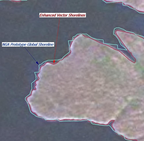
Enhanced Vector Shorelines are derived from Landsat ETM+ mosaics. When I carefully digitize an island shoreline using Landsat imagery as my base image, I create EVS precision vectors. This name describes an improved shoreline over World Vector Shorelines.
The NGA Prototype Global Shoreline claims to be a global vector shoreline derived from Landsat ETM+ mosaics, the same imagery I use. When I first learned of it, I thought to myself, "My work is done! MDA has produced the ultimate global vector shoreline. Well, they really haven't. It seems that their shorelines do not track Landsat's imaged shorelines. They are close, somettimes very close. But far too often, they are off, sometimes by 100's of feet.
It is my contention, if Landsat provides a clearly imaged shoreline, the vectors that describe that shoreline should be as close to the shoreline as possible. NGA PGS does a pretty good job, but when I compare their product to my EVS precision shorelines - mine are better at tracking the Landsat imaged shoreline.
Enjoy!
No comments:
Post a Comment