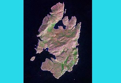
Kyra Panagia - LIIM From Landsat N-35-35_2000
A few nights ago I decided to make a map from one of my Greek and Turkish Island LIIMs. I selected one at random. I initially had it identified as Nisos Pelagos. It turns out that the Greeks named the island after a monastery located on this island.
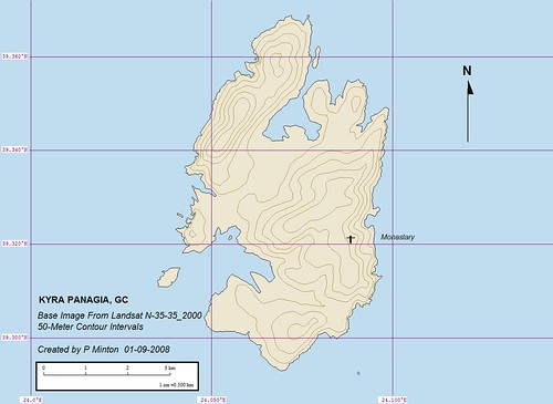
Kyra Panagia - EVS Percision Marplot Map (1:50,000)
The map I produced is above. EVS precision is the best resolution freely available. So I used the LIIM to create my map. Nothing much out of the ordinary to report. The map was created in less than four hours. What I found out about the island in the research phase, now that is interesting.
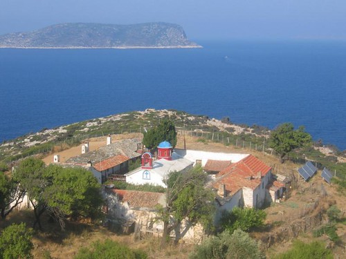
Kyra Panagia Monastery (Overview)
This humble monastery is monk-less. The last monk died in 1991. Tourist haul into Monastery Bay, climb Monks Steps and tour the only building on the island - this monastery. It turns out the island is uninhabited. It is a protected area - some sort of National Park status. So, if you are hunting for the ultimate get-away, this is your destination.
Enjoy!
No comments:
Post a Comment