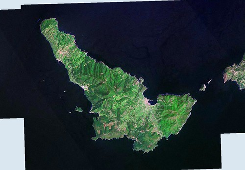
Nisos Skopelos - LIIM From N-34-35_2000 (1:100,000)
Nisos Skopelos is a fertile and densely-wooded island. Adjacent to the town of Skopelos is a harbor that handles the ferry boat traffic - tourists and goods from the mainland. There are a few smaller harbors that provide safe haven for the sailing crowd, especially the harbor at Ormos Glossa.
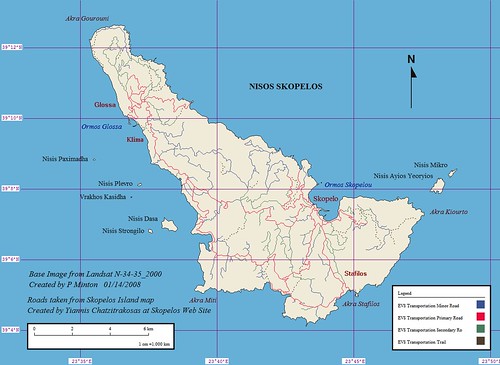
Nisos Skopelos - EVS Precision Map with Roads (1:100,000)
This island project took about 6-hours to complete. The shoreline was completed quickly. The feature that took the greatest amount of time was the island's intricate road network. I used a map found on Skopelos Web Site. I georeferenced the map and placed it on top of my base image. I then carefully digitized the road network, paying special attention to the size classification of the roads. I imported the completed files into Marplot where I finished this map. The names and locations of various island features were taken from Sailing Directions Pub 132, Section 16-10.
I have secured approval to use the road network on this map from the copyright owner, Yiannis Chatzitrakosas. Landsat ETM+ does a poor job of showing roads and trails, where as Yiannis' map shows all class of roads on the island..
Enjoy!
No comments:
Post a Comment